
Things to See in and around Merriwa
Heritage Buildings
Catholic Complex
As you enter Merriwa from Scone you come to a T-intersection on the northern outskirts of town. Opposite is an attractive sandstone building with a fine verandah which is St Joseph’s Primary School, established as a convent by four sisters of St Joseph from Lochinvar in 1885. A wooden building served as their residence until the present stone building was erected in 1918.
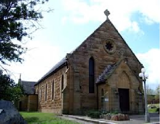
Just around the corner is St Anne’s Roman Catholic Church which was built in 1879-81 to a design by J.W. Pender, with extensions in 1938. The first Catholic church in town dates from 1858.
Old Sandstone Cottage
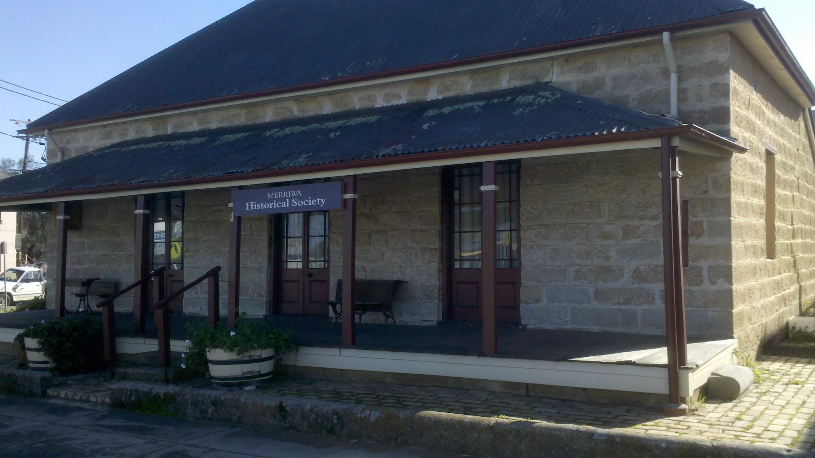
Located on the corner of Bettington and Bow Streets is the Merriwa Historical Cottage which houses the Merriwa Tourist Centre and the Merriwa Historical Society Museum. The sandstone cottage was built in 1857 as a private residence. It is thought that a series of banks operated from there between 1871 and the early 20th century. It was dedicated as a museum in 1967.
It is open Monday and Tuesday from 9.30 am – 1.30 pm and Friday and Saturday 9.30 am – 12.30 pm. For more information tel: (02) 6548 2673
Tourist Information
Continue down McCartney St to Bow St and turn left, following it to the intersection with Bettington St, the main road. The town centre has been declared an urban conservation area.
At the corner of Bettington and Bow Sts is the Merriwa Historical Cottage which houses the Merriwa Tourist Centre and the Merriwa Historical Society Museum. The sandstone cottage was built sometime between 1847 and 1856 as a private residence. It is thought that a series of banks operated from there between 1871 and the early 20th century. The School of Arts used the basement as a meeting place from 1869 until they received their own building in 1876. Dances were held here in the 1920s.
Today there is a modest display relating to local history in the back rooms. The information centre is open from 10.00 a.m. – 3.00 p.m. daily. It has self-guided historical walks brochures, tel: (02) 6548 2505. At the front of the building, by Bettington St, is the headstone of the Chinese cook from the Fitzroy Hotel who, at one stage, lived in the cottage cellar.
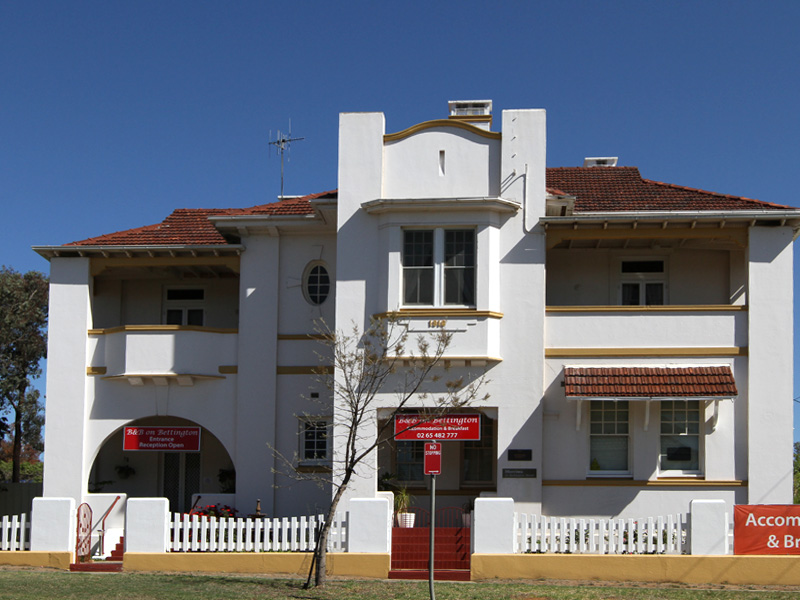
National Australia Bank
located in Bettington Street this prominent building, an example of early 20th century commercial architecture in country towns, was built in 1916 for the Commercial Bank. It is now used as a bed and breakfast.
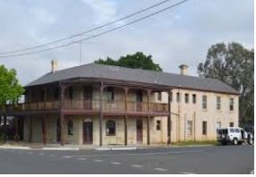
Fitzroy Hotel
Over the road is the Fitzroy Hotel (1892). It was built for James Ell, then co-owner of The Royal Mail and Passenger coaches which departed from the hotel on a daily basis for Gungal, Muswellbrook and Denman.
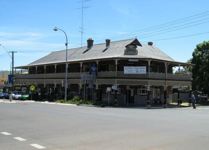
Royal Hotel
The Royal Hotel was erected in 1914 on the site of the old Cricketer’s Arms Inn which dated from the 1850s. When it was built it was recognised as having some of the best service of any country hotel in the state.
Police Station and Court House
Located in Vennacher Street is the sandstone courthouse, built in 1858 with additions made in 1866 and 1885.
Merriwa Central School Primary – Near the intersection with Vennacher Street is the primary school, opened as a public school in 1850. The gate posts and the stonework come from the homestead of explorer William Charles Wentworth. He was a member of the first European party to find a route across the Blue Mountains in 1813. The sundial in the schoolyard belonged to Charles Blaxland, brother of explorer Gregory Blaxland and one of the first land grantees in the area.
Classroom and Principal’s Residence
In Mackenzie Street near the end of the road is a sandstone building which was originally a classroom of the town’s first National School (1878). Adjoining it is the headmaster’s residence (1878) which still serves as the home of the school principal
Holy Trinity Anglican Church
Continue south along Bow St to the Holy Trinity Anglican Church, built in 1899-1900 to replace the original 1855 timber church which was consecrated by Bishop Tyrrell. Anglican services began in Merriwa in 1848. The tower is a memorial to Reverend William Wilson who once rode 1300 km on horseback investigating his parish.
The old graveyard is behind the church. It contains the tomb of James Roper who accompanied Ludwig Leichhardt on his famous overland expedition from Brisbane to Port Essington (in the Northern Territory) in 1844-45. Roper was the first European to see the Roper River in the Northern Territory which was named by Leichhardt in his honour. He became government stock inspector at Merriwa in 1868 and was prominent in local affairs. The monument was erected from a fund started by the Sydney Daily Telegraph upon his death in 1895.
The rectory, built in 1875, is at the south-western corner of town, by the corner of Gooch and Glebe Sts. Over the road from the church is the Shire Hall (1911) and the timber School of Arts, built in 1876 and used for a time as the shire hall.
Church Graveyard
The old graveyard behind the church contains the tomb of James Roper who accompanied Ludwig Leichhardt on his famous overland expedition from Brisbane to Port Essington in 1844-45. Roper was the first European to see the Roper River in the Northern Territory which Leichhardt named in his honour. He became government stock inspector at Merriwa in 1868 and was prominent in local affairs. The monument was erected from a fund started by the Sydney Daily Telegraph upon his death in 1895
School Buildings
Continue south along Bow St. At the next intersection turn right into Mackenzie St. Near the end of the road, to the right, is a sandstone building which was originally a classroom of the town’s first National School (1878). Adjoining it is the headmaster’s residence (1878) which still serves as the home of the school principal.
Return along Mackenzie St, across Bow St. Near the intersection with Vennacher St, to the right, is the primary school, established in 1885. The gate posts and the stonework come from the homestead of noted explorer W.C. Wentworth. He was a member of the first European party to find a route across the Blue Mountains in 1813. The sundial in the school yard belonged to Charles Blaxland, brother of explorer Gregory Blaxland and one of the first land grantees in the area.
Bottle Museum and Steam Engine
The Bottle Museum has over 5000 bottles of all shapes, sizes, modes of construction and functions, dug up from local properties by a father and son. Some date back to the early 19th century. There is also a rock and mineral display and a collection of pre-decimal currency. They are open from 8.30 a.m. – 5.00 p.m. weekdays.
Opposite, by the pool, is a Brittania Steam Engine, imported from England in 1890 to power a Wolseley sheep-shearing machine at Charles Blaxland’s Cullingral station, west of town. The first large-scale mechanical shearing in Australia had taken place in 1888.
The Town Centre
On the south-eastern corner of Vennacher and Bettington Sts is the National Bank, situated in the old CBC bank building, built in 1916. Opposite is the enormous Royal Hotel, which was erected in 1914 on the site of the old Cricketer’s Arms Inn (1850s).
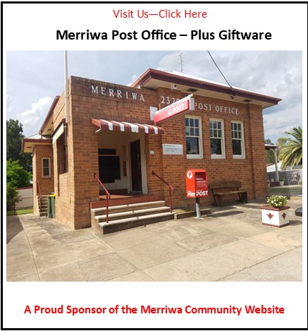
Turn right into Bettington and a short distance along, to the left, is the post office, built in 1888. Opposite is Memorial Park, the site of the town’s first Catholic Church (1858) and cemetery. Return along Bettington and turn right into Vennacher St. On the left is the sandstone courthouse, built in 1858 with additions made in 1866 and 1885.
The Kurrajong Tree at 133 Bettington St is a gift and craft shop open every day but Sunday. Merriwa Country Gifts is at 98 Bettington St.
Britannia Steam Engine
Opposite, beside the pool, is a Brittania Steam Engine, imported from England in 1890 to power a Wolseley sheep-shearing machine at Charles Blaxland’s Cullingral station. The first large-scale mechanical shearing in Australia took place here in 1888.
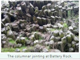
The Battery
15 km from the town of Merriwa, along the road to Muswellbrook, is the Battery Picnic Area which is situated around a remarkable rock formation consisting of lava that has cooled to form cylindrical columns which cluster along the cliff face like a series of organ pipes or pencils. The phenomen is known as columnar jointing.
Goulburn River National Park
The Goulburn River National Park is located to the south-east of town. It covers around 70 000 ha of land adjacent the river which makes its way past sandstone cliffs, caves and gorges which contain numerous Aboriginal stencils and paintings. There are also axe-grinding grooves, campsites, scarred trees and quarries. It is thought that the abundance of cultural material (some 250 sites) reflects the fact that the area was situated on a major trading route between the coast and the western plains.
The park is a haven for eastern grey kangaroos, red-necked wallabies, wallaroos, wombats, goannas, water dragons, turtles and numerous bird species, including lyrebirds, wedge-tailed eagles, parrots and emus. River oaks, narrow-leaved ironbarks, narrow-leaved stringybarks and rough-barked apple dominate the riverbanks and river flats.
The major access road is Ringwood Rd. It heads south from the Merriwa-Cassilis Rd, 6.7 km west of the bridge on the western outskirts of Merriwa. There are no camping facilities but there are plenty of opportunities for bush camping. White Box Camp is available for vehicle-based camping. Spring Gully is a campsite by the river, although it lies along what is really a 4WD track, suitable only in dry weather.
9 km down Ringwood Rd is a roadside sign indicating a gem fossicking area to the right. Bushwalking is another obvious attraction. The most easily accessible trail is that to Lees Pinch Lookout. A signpost 13.5 km down Ringwood Rd indicates the starting point of the walk. It is a short distance to some spectacular elevated views from the escarpment to the eastern section of the park.
Mt Dangar (670 m above sea-level), in the south-eastern corner of the park, is also considered a suitable destination for walkers, offering an exceptional panorama of the area. It was sited in 1824 by Henry Dangar who named it Mt Cupola but renamed by Allan Cunningham who became the first European to climb it the following year.
Those interested in photography and wildlife observation will also find the park rewarding. Topographic maps and further information are available by contacting (02) 6543 3533.